

Archive Record
Images
Additional Images [3]
Metadata
Accession # |
A2004.202 |
Title |
Fergus, aerial photographs, 1948; ca.1960. |
Date |
1948, 1960 CIRCA |
Description |
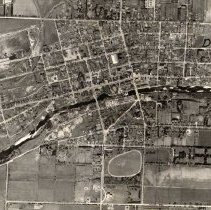
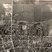
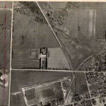
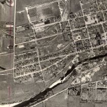
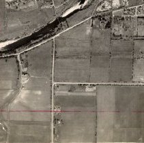
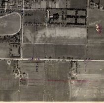
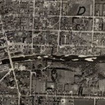
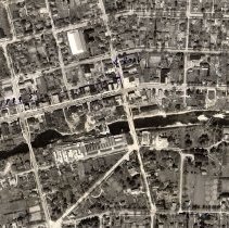
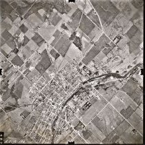
Two aerial photographs of Town of Fergus: ph 18534: Fergus and some surrounding countryside in Nichol and West Garafraxa Townships, 1948. [Six houses on Brock Avenue were built by Beatty Bros. in 1935, and all six are complete and visible here. The neighbouring houses at 559, 569, and 579 James Street, in the northeast section of Fergus, were each built in 1948 according to MPAC data. This photograph shows the houses newly built with lawns yet unsodded]. Some markings in red pencil and black ink. Shows "swing bridge"; High School with addition at rear, cemetery, Beatty Bros. factories, Grand River, roads and buildings. 46 x 46 cm. [MC67] [For additional information see A2023.61, page 304] ph 18535: ca.1960, 25 x 25 cm., numbered A18273-194. Swing bridge is missing; High School, with additions at rear and north. |
Creator \ Maker |
Unknown [PHOTOGRAPHER] |
Item Name |
Print Map |
Person \ Organization |
Corporation of the Town of Fergus Beatty Brothers Belsyde Cemetery |
Place |
Belsyde Brock Street Fergus Grand River James Street St. Andrew Street St. David Street Swing Bridge, Fergus Tower Street Victoria Park |
Subject |
Geography Property Aerial View Mill Transportation Architecture Agriculture Cemetery Bridge |
Photo, Map # |
ph 18534 ph 18535 |
Year Range from |
1948 |
Year Range to |
1960 |
Accession # |
A2004.202 |
Containers |
MC67 STACKS |